

The links & PDF files provided for this course will add in the preparation for taking your Part 107 Exam. You will get information on flight courses, checklist, study guides, rules, regulations, charts, handbooks & much more
Preparation for Part 107 Read More »

This presentation, made available by the University of Hawaii at Honolulu, provides information about teaching Artificial Intelligence (AI) and its use in Smart Robots, Drones, and the Internet of Things in a classroom setting. AI is defined as “a technique which enables machines to mimic human behavior.” Artificial neural networks are described in detail, including:

This collection includes materials from the DroneTech Educator Workshop: Drones and Geospatial Applications that was held by the National Center for Autonomous Technologies (NCAT). “This workshop … focus[ed] on developing and integrating practical applications of Drone and Geospatial Technology use into curriculum. Ongoing applied research projects … provide[d] data and examples of how drones and
DRONETECH: Drones and Geospatial Applications Read More »
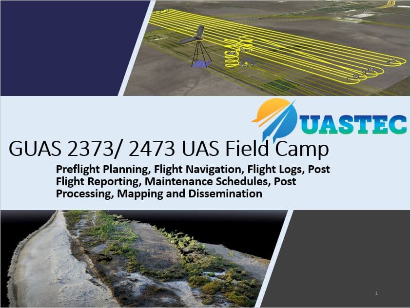
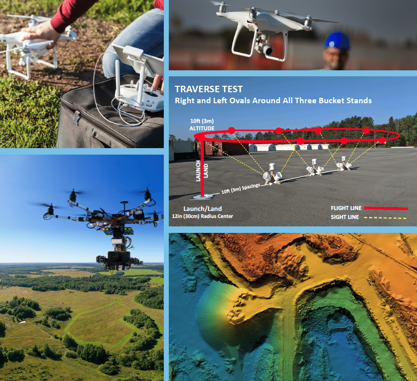
This course applies all of the theory and skills taught in the first two GUAS courses through hands-on field-based experience. Students will be responsible for planning and executing sUAS flight plans. They will spend their time in the field at FAA-approved flight sites to demonstrate live operation of sUAS platforms. This course follows up with

In this activity provided by the Unmanned Aircraft System operations Technician Education Program (UASTEP), students will learn to analyze multispectral images collected from a drone or unmanned aircraft system. Specifically, students will use the ArcGIS Pro software package to visualize, classify, and calculate the areas covered by different types of land cover. In addition, students
Supervised Classification of Drone Multispectral Images and Landcover Analysis Read More »
This course introduces students to the fundamentals of mapping with small Unmanned Aircraft Systems (soaps) using digital imaging sensors to produce high resolution, spatially accurate 2D and 3D geospatial data products. The course will cover the full spectrum of UAS mapping from survey design to data processing to product assessment. Students will learn the principles
Digital Mapping with UAS – GUAS 2372 UAS 102 Read More »
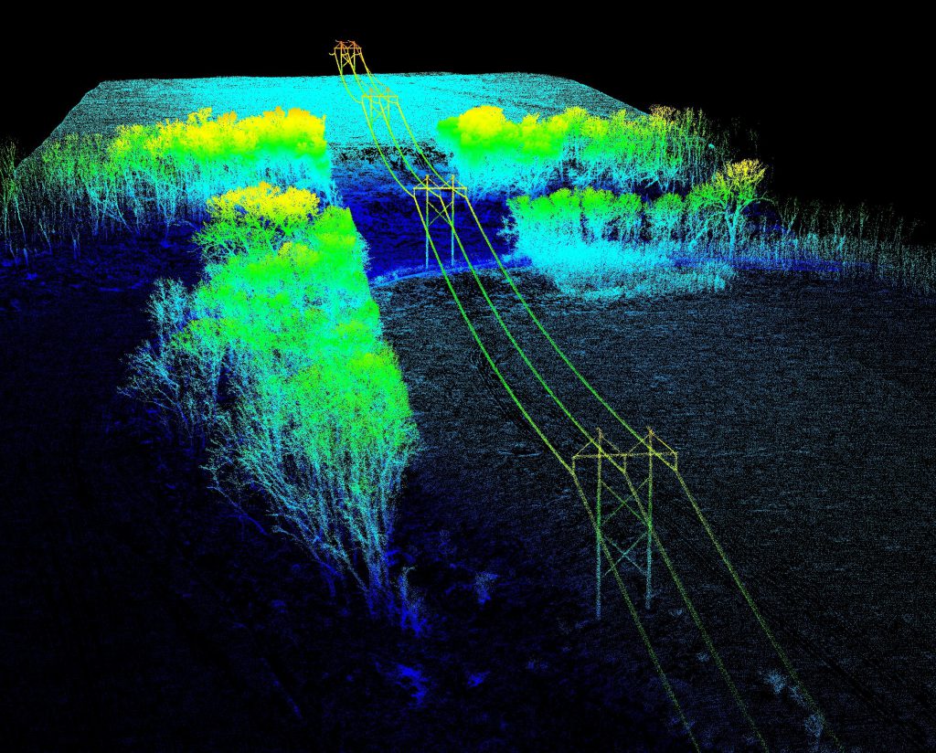
In this 4-page activity, provided by the Unmanned Aircraft System operations Technician Education Program (UASTEP), students are introduced to some of the properties (i.e. return value, point count) of LiDAR data gathered by a sensor mounted on a drone or unmanned aircraft system. In addition, students use spatial analysis tools in the ArcGIS Pro software
An Introduction to Visualizing and Analyzing LiDAR Data from Drones Read More »
In this activity provided by the Unmanned Aircraft System operations Technician Education Program (UASTEP), students will be introduced to a multispectral sensor that can be used with a drone or unmanned aircraft system. In addition, students will analyze multispectral data from the sensor by using a variety of geoprocessing tools found in the ArcGIS Pro
Unsupervised Classification of Drone Multispectral Images and Landcover Analysis Read More »