

This all-online, face-to-face, or hybrid exploratory course introduces you to the fundamental concepts of Geospatial Science and how Geospatial Technology (GST) is used to measure, imagine, study, and discover our complex and everchanging human and natural world. You will learn the basic techniques of cartography (mapping), GPS (global positioning systems), GIS (Geographic 1 Information Systems),
Exploring Our World Through Geospatial Technology (GEOG 1890) Read More »
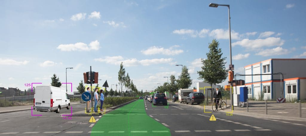
A course in the Vehicle Engineering Technician, Automotive Technology Associate Degree at Macomb Community College This course introduces students to principles of sensors (GPS, MEMS, LIDAR, Radar, Ultrasonic, Infrared) used in connected and automated vehicles, locomotion, autonomous mobile robots.
IT311 – Sensors Used in Connected and Automated Vehicles Read More »
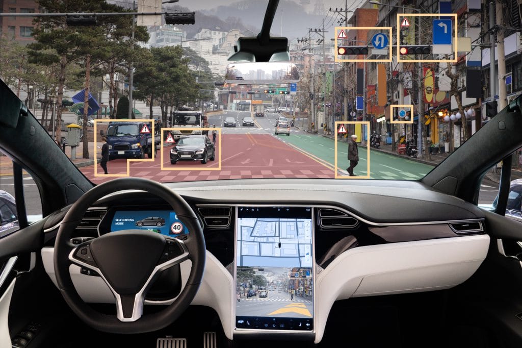
This course introduces students to principles of navigation techniques used in connected and automated vehicles. Topics include autonomous navigation and connected vehicles, basic navigational mathematics, mobile robot positioning, inertial sensors and navigation systems, global positioning system, kalman-fitering techniques, integrated navigation system, multisensory integrated navigation, fault detection and integrity monitoring, and communication among connected vehicles.
IT 312: Navigation Techniques Used in Connected and Automated Vehicles Read More »

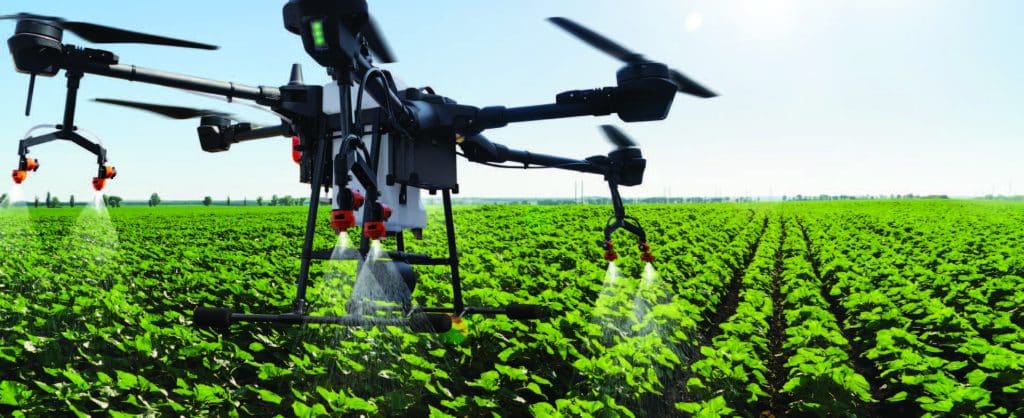
This PowerPoint presentation, made available by Clark State Community College, provides basic information on twelve different mobile applications that can be used to aid in various aspects of precision agriculture. Examples of application utility include drone monitoring, crop management, use of satellite imagery to monitor crops, plant stand calculations, weed identification, and more.
Apps for Precision Agriculture Read More »