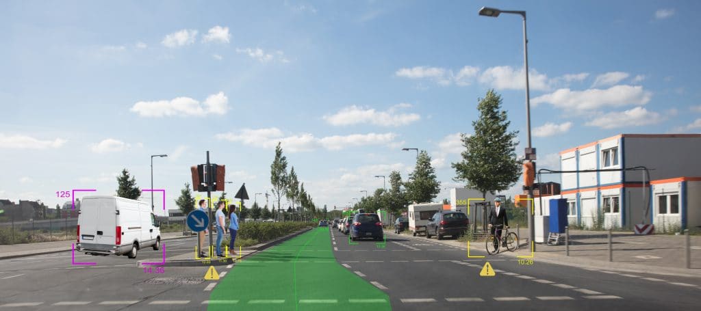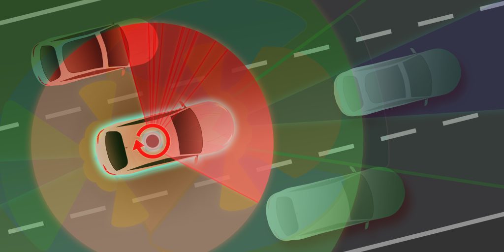
Fundamentals of LiDAR Technologies
This 45-page resource, from Baker College, is an educational module that provides theoretical knowledge about the growing technology of Lidar. The module includes a laboratory component where students experiment with an industry grade commercial Lidar device and learn hands-on about its features and performance. The module can be embedded in courses in photonics, electronics, advanced […]
Fundamentals of LiDAR Technologies Read More »