
Tell us about yourself and your background
One of my favorite quotes is by Arnold Edinborough, “Curiosity is the very basis of education, and if you tell me that curiosity killed the cat, I say the cat died nobly.” This kind of sums up my outlook on both education and life, and it also adds a bit of humor. Seriously, though, I love learning, and this winding curiosity path is how I ended up being involved in geospatial technologies, including autonomous technologies and unmanned aircraft systems (UAS).
I have been teaching chemistry for thirteen years now, but my road to Germanna as a chemistry professor actually started in 1995. This was when I first enrolled in classes at Saint Louis Community College at Meramec (SLCC) after being out of high school for eight years. I was married and had two children by then, and SLCC-Meramec was an excellent place to begin my degree. (Locally, the school is known as “MIT”, which stands for “Meramec In Town.”) I started my studies in history and horticulture, but within a year, I found chemistry and knew that I wanted to major in it. Much of my excitement for chemistry stemmed from the truly dedicated and amazing professors who taught at SLCC. I transferred to Washington University in St. Louis as a junior, finished my degree, and continued on to graduate school there, finally earning a Ph. D. in Inorganic Chemistry (concentration in nanoscience) in 2006. After I graduated, I knew that I eventually wanted to teach at a community college, and I wanted to give back to the community that gave so much to me. On a more personal note, I have a wonderful husband, Bill, and we have four grown kids between us (Kara and Andrew, Becky and Shelby), and a granddaughter Charlotte. We also have two fur babies (cats), Yinyin and Otis. 🙂 Bill and I enjoy working out at the gym, going on hikes and cycling. We travel around the US whenever we can; often with just a general plan that we fill in as we go. We were going to be traveling to Alaska again this coming summer, but the pandemic got in the way. Now it will be next summer, and we are over-the-moon excited.
How did you get started in the industry you are in? What interested you most about it?
I was first introduced to geospatial technology as a participant in an NSF-ATE grant led by Virginia Space Grant Consortium (VSGC) in partnership with Virginia Tech, Virginia Community College System, Thomas Nelson Community Colleges and other partners. This is where I first met the GeoTEd team. I have always been interested in pattern recognition and data analysis, and the little I knew about geospatial tech at the time piqued my interest.
I applied to and was accepted into the GeoTEd Geospatial Faculty Institute in 2012. Two seven-day workshops were held at Virginia Tech during June 2013 and 2014. The first workshop involved intensive learning of geospatial concepts, such as GPS, ArcGIS for desktop, remote sensing, and ArcGIS Online. We were expected to integrate these concepts into our courses over the next year. The second week-long workshop focused on anchoring skills learned the first workshop and significantly expanding the use of ArcGIS Online, geospatial analysis in ArcGIS 10.1, and further aspects remote sensing technology. These two summer workshops greatly expanded my understanding of geospatial software and applications, and their potential for use in student research projects in chemistry. In June 2015, I attended the VSGC STEM Takes Flight Case Study Workshop held at NASA Goddard Space Flight Center’s Wallops Flight Facility for selected Virginia community college STEM faculty. All of these training opportunities have been extremely valuable in developing a knowledge base and catalyzing ideas to apply geospatial technology concepts in science courses.
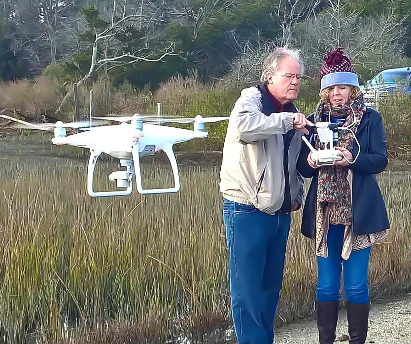
When the GeoTEd team was funded for another follow-on NSF-ATE project, Geospatial Technician Education-UAS (GeoTEd-UAS), I was very excited to participate. These institutes would focus on integrating UAS into the classroom. I completed the GeoTEd-UAS 2017-18 UAS Professional Development Institutes and received my FAA Part 107 Remote Pilot Certificate. The week-long workshops were held at Virginia Tech during May 2017 and 2018, and each required completion of a final project as part of two graduate classes. I earned six graduate credits from Virginia Tech in Nov 2018.
I have also been gradually completing a Master’s program in Geospatial Information Technology at Northeastern University. My goals for the master’s in Geospatial Information Technologies center around three main career goals; developing student research projects using GIS, UAS (drones) and remote sensing for the Science Capstone courses, certification to teach introductory GIS and RS courses, and gaining geospatial technology background to use in building geospatial program at our college, including UAS.
In 2019, I was also chosen to present a poster and represent the GeoTEd-UAS project as a student participant at the NSF ATE PI Conference in Washington, DC. I enjoyed learning about engaging students in STEM courses, as well as increasing student success in these career pathways. I also greatly increased my knowledge about the development of undergraduate research programs and/or service-learning projects for students at our community college. Since the development of career pathways in GIS/UAS/RS is a strong topic for discussion at our college, I really valued the opportunity to learn more about the development and implementation of autonomous technology programs from others who have successfully done it.
I am now a Co-PI on the newest NSF-ATE grant “Improving Pathways Into the Geospatial and Unmanned Aircraft Systems Technician Workforce (GeoTEd-UAS).” I am so excited to work with the rest of the team, and I have already learned so much about applying and working on a grant project. I am the least experienced with UAS on the team, which puts me in a great position to deepen my existing knowledge in this field.
Tell us about your organization and your role
I am a Professor of Chemistry at Germanna Community College, and recently I have started teaching GIS courses (and I will soon be teaching UAS courses, as well). Germanna Community College is a two-year college with a diverse student body (rural, suburban, URM, and first-generation college students). We are located in Fredericksburg, Virginia, which is part of the Washington, DC metro area. I completed my Ph.D. in Chemistry in 2006, and I have taught at the University/Community College level ever since.
What do you enjoy must about working in the industry you are in?
I call myself a “creature of academia,” because that is the only industry that I have worked in. After I completed graduate school, I did research in chemistry for about 6 months before beginning my teaching career as a Lecturer in Chemistry at Washington University. I taught there for five years, but I had always wanted to teach at a community college. After a job search, I found Germanna, which was a perfect fit for me. I love being a professor, since it allows me to work with a wonderful and diverse group of students every semester, as well as continuously learn new things and develop expertise and curriculum. A huge part of my motivation every day is knowing that students at our college are gaining skills to improve their lives and those of their families. I like to think of it as leveling the playing field for students who are disadvantaged, and I am so passionate about being a part of that.
Share a success story
When I first applied to be a participant in the GeoTEd Geospatial Institute in the fall of 2012, I never imagined where that journey would take me. The first four days of the workshop mainly focused on GIS, so I was a bit nervous about how I could create a chemistry lab that would fit the curriculum and introduce students to geospatial concepts. And then we talked about remote sensing, and everything clicked.
(Passive) remote sensing and spectroscopy in the chemistry lab are very closely related, but they applied to different scales. Both use a variety of wavelengths in the electromagnetic spectrum to derive information about a given material without direct contact.
For instance, UV-vis spectroscopy is often used to analyze colored compounds in chemistry, and provides important information about the structure and electronic environment within a given compound. Chemistry generally use absorption spectroscopy, where remote sensing focuses on the wavelengths that are reflected (reflectance spectroscopy or imaging spectroscopy). Either approach gives important information about the materials under study. Students in General Chemistry at Germanna are now introduced to spectroscopic concepts and applications in lab with reflectance spectroscopy first. Students collect their own materials to analyze, as well as walking around campus finding new materials. Students love the application to the “real world”, and most of them find the data collection and analysis process associated with these labs to be quite fun.
Share a failure and what you learned from it
Along any journey worth taking, failures are sure to be encountered, and my experience has been no different. I would actually call my road a series of failures that ultimately lead to our current success. After I attended the first GeoTEd institutes in 2013 and 2014, I knew that I wanted to develop skills and earn a teaching credential in remote sensing and GIS. Putting that idea into a plan to actually begin a geospatial technology program at Germanna Community College was a whole lot more complicated.
Our region in Virginia is well suited for such a program, with numerous companies, governmental agencies, and the military offering internships and employment in this field. However, doing the research and presenting the information to the administration in a clear and convincing way is a whole other matter. I tried to get drones for the Science Department (several times), I wrote asking to offer a GIS class, and the answer to all of these was a friendly “no.” Finally, I wrote to just get permission to integrate GIS as a lab science in the science AA&S for certain tracks, such as environmental science and geology. That one worked, and we were allowed to offer GIS 200 the next year. About two years later (after several rejections), we got approval to explore offering a program. Finally, everything came together when I joined the GeoTEd team, and Germanna is now in process of building a geospatial technology program, including UAS!
My take-home message? Hard work, optimism, and persistence is the antidote to setbacks.
Any tips you would like to share with others in the industry?
Hmmm, honestly? I’m a newbie and still learning from the tips I get!
What excites you most about the future of autonomous technologies?
Being able to gather remote sensing data on a local level in (close to) real time with lower cost. I am excited about (eventually) using UAS-collected multi- and hyperspectral imagery to investigate how spectroscopy can be used to identify materials and assess plant health, including disease detection at early stages. Mapping invasive species is another interesting application. Projects would be chosen in our local region, and students would have the opportunity to help plan our service-learning adventures.
I am working to obtain a UAS with a multispectral sensor to relate spectral signatures for various compounds obtained in the lab to field-obtained measurements. Even better would be a hyperspectral sensor, since this would more closely align with the narrow wavelength bands in instruments used in the chemistry lab. This is the true goal as they come down in price.
What would you say to people who are skeptical about autonomous technology?
I would let them know that they already encounter it every day! Newer vehicles are equipped with sensors as part of an autonomous collision avoidance system. Another example of an autonomous system is a vacuum robot at home. Mine is named Roberto, and it vacuums our entire first floor without me lifting a finger (even over area rugs). Understanding various forms of electromagnetic radiation and how various sensors work (i.e., radar, LIDAR, GPS) would also help address skepticism.