

Northland Community and Technical College has partnered with the Pennington County Soil and Water Conservation District (SWCD) and the Minnesota Board of Water and Soil Resources (BWSR) to evaluate 50 county ditches as they empty into the three rivers in Pennington County. BWSR is an agency that oversees the County SWCD’s in Minnesota. Both BWSR and SWCD are responsible for improving and protecting the soil and water resources across the state.
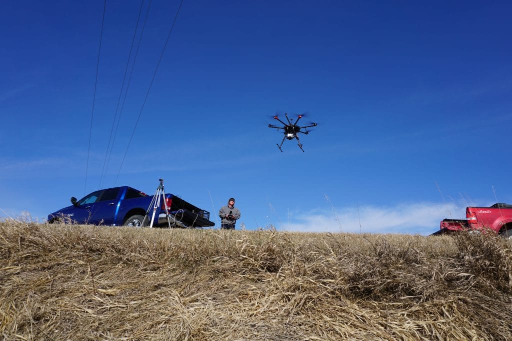
The Northland Community and Technical College Aerospace Site’s primary responsibilities include providing aerial imaging using Small Unmanned Aircraft Systems (sUAS), or more commonly known as “drones” to evaluate the conditions of about 50 county ditches as they empty into the Thief River, Red Lake River and the Black River. “We are looking mainly at the amount of erosion and sediment deposit from year-to-year” says Chris Rohlfing, Northland Community and Technical College graduate of the sUAS Field Service Technician program. Rohlfing is currently serving as an independent contractor on the project and comes with three years of experience working with sUAS and Geographic Information Systems (GIS).
The SWCD and BWSR partnered with Northland Community and Technical College to assist with determining the amount of erosion and sediment deposit from year-to-year that is taking place in the ditches emptying into the Pennington County rivers. By using sUAS equipped with LiDAR collection equipment, the Northland team can efficiently create a georeferenced 3D model of the ditch. By utilizing this method of surveying, they are saving the SWCD and BWSR an incredible amount of time compared to using the traditional method of having a technician in the field with ground surveying equipment. “We are able to fly the sUAS over the same area each year and use that data gathered and develop 3D models to evaluate the condition of the county ditch” stated Rohlfing. In presenting that data to the SWCD and BWSR, they can then determine whether a ditch requires maintenance.
“As we begin to analyze and compare the data between the past two years, the results are looking good. For example, when a body of moving water curves around, naturally over time there will be erosion around the outside bank of the curve while depositing sediment on the inside bank of that curve. One ditch snakes around just before emptying into the river and preliminary analysis shows exactly that occurring,” stated Rohlfing. From there, the Northland team is able to calculate the volumetrics of how much soil has been lost in those areas. The SWCD can then determine if or when they need to implement conservation practices to prevent any unnecessary soil loss.
The Northland team is currently gathering data for the final year of the grant. Once the data collection is complete, Northland will provide the SWCD and BWSR a comparison for the ditches from year-to-year to allow BWSR to develop a maintenance plan.